Killarney Lake Manitoba, Canada
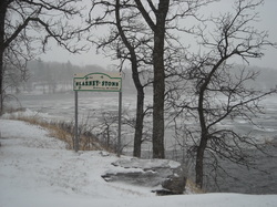
In more than 100
years Killarney has grown into a thriving and prosperous rural
community. Rooted deeply in agriculture, the first permanent settlers to
the region were homesteaders, coming from all corners of the world,
looking for adventure, freedom and affordable farmland. But before the
settlement of these pioneers, this area was well known by fur traders,
explorers and Natives who lived and trapped along the northern edge of
the Turtle Mountains, which straddle the Canada-U.S. border to the south
of Killarney.
Land surveyor and
homesteader John Sydney O’Brien named Killarney Lake, because the
landscape reminded the Irishman of home. “I think we should call this
lake Killarney, after the beautiful hills of the homeland,” said
O’Brien. He then dumped a pint of the Irish in the lake and baptized it
Killarney.
The 1880’s were
busy years, with the establishment of the R.M. of Turtle Mountain in
1882. The following year the first store was built in the community that
was quickly forming near Killarney Lake. In 1885 the railway came
through and by the following decade the population grew to 300 people.
In 1903 Killarney was incorporated as a village, breaking away from the
R.M. of Turtle Mountain.
Three years
later, in 1906, it officially became a town. The community has struggled
and succeeded through two world wars and the Great Depression. With the
success of the entire rural and urban community in mind, the Town of
Killarney and R.M. of Turtle Mountain have worked as partners to provide
the best possible services and opportunities for growth to local
residents. In recent years it became apparent that officially combining
their resources could only make the community stronger.
On January 1,
2007 the two municipalities made the historic move to merge back
together, like they were in the very beginning, to form the newly
amalgamated Municipality of Killarney-Turtle Mountain.
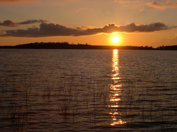
William Lake Manitoba, Canada
The Turtle Mountain region is the oldest inhabited part of the province, since it was the first dry land that appeared after the glacial period. Coniferous forests quickly became established and waterfowl, mammoth and, perhaps, giant bison attracted small groups of nomadic hunters. Little is known about these people as no campsites have yet been discovered in Manitoba for archaeological study. Only a handful of scattered stone tools tell of their presence.
About 10,000 years ago the last of the glacial ice had melted and local topography generally took on its present contours. A major climatic change caused the replacement of the forests with grasslands. Hunting and gathering began on the prairie, and persisted well into the 19th century.
Today it is difficult to imagine how one type of animal could be the life-source for a diversity of people for many thousands of years. Yet this was the case for many of North America's First Nations on the Great Plains. The buffalo (bison) was a source of food, shelter, clothing, tools, utensils and weapons. It was also prominent in religious ceremonies, songs and legends. When fuelwood was scarce on the open prairie the animal's droppings, known to explorers as "buffalo chips" were used for campfires. For countless generations winters ended when the warm, buffalo-scented winds from the south and west announced the returning herds and the start of spring.
In the early 19th century a new people of mixed Native and European origin appeared on the prairie. The Métis, who lived in the Red River settlement, were primarily buffalo hunters. Between 1810 and 1870 they made annual hunting trips into western Manitoba. As many as 2,500 men, women and children made the journey in Red River carts for the big hunt.
In the later years, as the herds diminished, they made hunting trips into Saskatchewan and Montana. Some of the hunters wintered in Turtle Mountain rather than make a long journey in the summer from Fort Garry. As the hunting way of life disappeared, many Métis set up homesteads in this area.
Although the 49th parallel was agreed upon as the boundary between Canada and the USA much earlier, it wasn't until 1872-74 that the actual border was surveyed.
The work of locating the border, cutting the line and building earthen mounds began in winter at Lake of the Woods. In spring, the Canadian survey team moved westward in a train of ox-drawn covered wagons. Along the way they established astronomical stations to determine the latitude, and a series of supply depots such as that on the east side of Turtle Mountain. Depots were regularly supplied with food and equipment from Fort Dufferin situated near the present town of Emerson.
Several members of the Boundary Commission Survey team were photographers whose painstaking work resulted in a visual record of this historic event. In addition, they captured the dying days of the wild prairie. All that remained of the life-giving buffalo herds in Manitoba were their scattered, sunbleached bones. In 1874 the newly formed North-West Mounted Police (NWMP) made their historic trek to the West, in the footsteps of the surveyors, past Turtle Mountain.
Boissevain Reservoir Manitoba, Canada
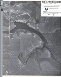
The “Garden of Manitoba” is the term that has often been used to describe the region between the Souris River and the Turtle Mountains in which Boissevain and Morton municipality are located. Eons ago, as the Lake Souris glacier retreated northward it left behind a sand loam which is well suited to dry land type farming.
Sometime in the late 1500s, long after the glacier had receded, the first inhabitants of the area were the Assiniboine First Nation tribe. Their habitation has been documented by the many artifacts discovered in this area in recent years. The first white explorers arrived in 1738 and Alexander Henry (1806). The arrival of these explorers ultimately led to the further exploration and investigation of this region.
Between 1873 and 1875 the Boundary Commission marked the international boundary. The trail they made was followed by a trickle of settlers coming west from Ontario who were looking for good land, good water and wood. In 1881 the first of several parties from Britain arrived in the area, not waiting for the railroad which was slowly extended to Boissevain by 1885.
Originally called Cherry Creek, the name was changed in 1889 to Boissevain in honor of the Dutch financier Adolphe Boissevain whose banking firm introduced CPR shares for sale in Europe to increase the speed of the building of the railway. The motto on the Boissevain family crest now adopted by the town reads “No fear of the future nor regrets of the past”. Boissevain was incorporated as a town in 1906.
The rural area around Boissevain is called Morton Municipality. It took its name from an early settler, George Morton. He was an energetic entrepreneur who built a store and grain warehouse in the area, which were only two of his many business ventures.
